Cecil Hills was created after the subdivision of Cecil Park and was officially gazetted on 2 October 1992.
Colonial Land Grants
John Wylde’s name appears on a list of people being granted land in the District of Cabramatta on 24 December 1816. Wylde arrived in the colony in 1816 to take up the position of Judge Advocate for the Colony. A grant of 810 hectares was made to him by Governor Macquarie in 1817. Wylde named his farm Cecil Hills after his home Cecil Lodge at Chestnut in Hertfordshire.

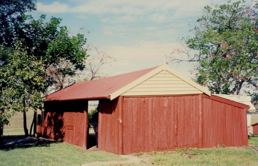
Cecil Hills Farmhouse, built between 1818-1824, on Sandringham Drive, Cecil Hills, 1996
Cecil Hills Farms has operated as a working farm for over 170 years. Wylde built the Cecil Hills farmhouse between 1818 and 1824. While his initial grant was 810 hectares, he acquired more adjoining land until he held 1450 hectares. The farm produced large quantities of meat for the government stores; in 1818, Cecil Hills was contracted to supply 6,000 pounds (2,720kgs) of meat.
For most of his time in the colony, Wylde lived in the city, only moving to Cecil Hills in 1824 when his post as Judge Advocate was abolished. He remained only briefly, leaving Sydney in 1825 with a son and daughter. was knighted in 1827 and was then appointed to the Supreme Court of the Cape of Good Hope.
His wife Elizabeth, pregnant with their ninth child, remained at Cecil Hills with the other six children and managed the farm successfully for a time. She became paralysed down her right side in 1859 and the farm became rundown. Elizabeth died in 1864 and is buried in Liverpool Pioneers’ Memorial Park. The farm was then worked for a number of years under leaseholders.
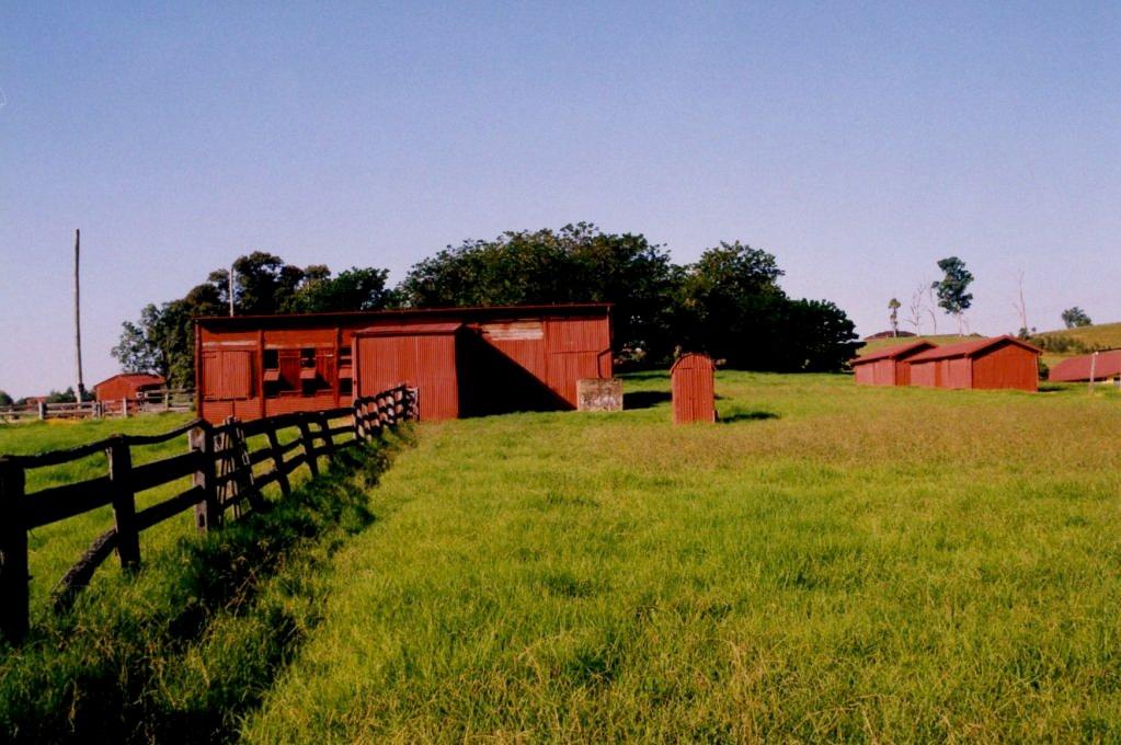
Cecil Hills Farmhouse still stands today on Sandringham Drive. It was extensively restored after a 1992 Heritage study. The main house is a rare example of brick nog construction. Brick nog, (nogging) is a construction technique in which bricks are used to fill the vacancies in a wooden frame. It is a single storey building with a hipped iron roof from about 1820. The rear of the house has had alterations. The garage, believed to be a former kitchen, is a small timber slab structure located to the rear of the main farmhouse. The original wallpaper suggests that the garage may have been used for domestic purposes. Other outbuildings include a stable, former cow bails, shearing shed, a small iron privy and a pair of corrugated iron sheds. Cecil Hills Farm is listed under Section 2, Items listed under the NSW Heritage Act and Section 3, Items listed by Local Government and State Agencies.

Outhouses of Cecil Hills Farmhouse, built between 1818-1824, on Sandringham Drive, Cecil Hills, date unknown
The other major landholder in the area was Barron Field, who held 810 hectares adjoining Wylde. Field named his property Hinchinbrook.
Prospect Reservoir
The upper canal system of Prospect Reservoir, located off Elizabeth Drive opposite the intersection with Wallgrove Road, has functioned as part of Sydney’s main water supply for over 120 years. The canal system represented a major engineering advance. Communities no longer had to depend on local water supplies, but could harvest water in upland catchment areas, storing it in major dams and transporting it to the city by canal and pipeline.
The Upper Canal System is an excellent example of 19th century hydraulic engineering, including the use of gravity fed water along the canal.
Prospect Reservoir is part of the Upper Nepean catchment scheme. It supplies water from the Cataract River at Broughton Pass to the Crown Street reservoir, a distance of 102 kilometres. The Upper Canal commences by tunnel from Pheasant’s Nest Weir through the local government areas of Wollondily, Liverpool, Holroyd, Fairfield, Camden and Campbelltown.
GEOGRAPHICAL NAMES ACT 1966 (1992, October 2). Government Gazette of the State of New South Wales (Sydney, NSW : 1901 - 2001), p. 7232. Retrieved May 25, 2021, from http://nla.gov.au/nla.news-article231915746
Liverpool City Library, Suburbs of Liverpool (2014). Available in the Local Studies Collection under LS994.41 Sub.
See something missing?
You know your suburb better than anyone. If you think an important part of your suburb’s history is missing, whether recent or distant, reach out to the Local Studies Team through our online Local and Family History enquiry form. We are always looking for new ways to bring the vibrant history of Liverpool to life!
