Liverpool is one of the oldest urban settlements in Australia. Liverpool was founded on the 7th of November 1810 by Governor Lachlan Macquarie. The suburb of Liverpool was officially gazetted on the 7th of April 1972.
What’s in a name?
Liverpool was named after Robert Banks Jenkinson, the second Earl of Liverpool and Secretary of State for the Colonies in 1810. Regarded as one of the most effective politicians of the 19th century, Liverpool also became Britain’s Prime Minister. Before his father’s death, and his ascension to the title of Earl, Jenkinson was known as Baron Hawkesbury. The Hawkesbury River is also named after him.
Macquarie had the acting Surveyor James Meehan mark out the area for the town of Liverpool, with a square in the centre as the site of a church. Most of the streets marked out for the original township are still in the same place, with the same names today:
- Macquarie Street was named for Governor Macquarie
- Bigge Street and Bigge Park were named for Commissioner Bigge who was sent from Britain in 1819 to see why Macquarie was spending so much money
- George Street was named for King George III
- Scott Street was named for Thomas Hobbes Scott, secretary to Commissioner Bigge
- Campbell Street was named for the family name of Governor Macquarie’s wife Elizabeth
- Moore Street was named for Thomas Moore, who introduced Governor Macquarie to the area.
From Colonial Settlement to Sydney’s Third CBD
Liverpool served as a major centre for the convict-based economy of the early colony. The earliest buildings constructed were the convict and military barracks, courthouse, goal, convict hospital and a branch of the Commissariat, built to cater for the needs of the administration and the purchase of produce from nearby farms. Liverpool is at the head of navigation of the Tucoreah-Georges River. The Tucoreah-Georges River provided natural resources, trade, communication and transport opportunities that allowed Liverpool to become a major agricultural and transportation centre. This capability increased in the late 1850s when the Great Southern Railway from Sydney to Melbourne was completed.

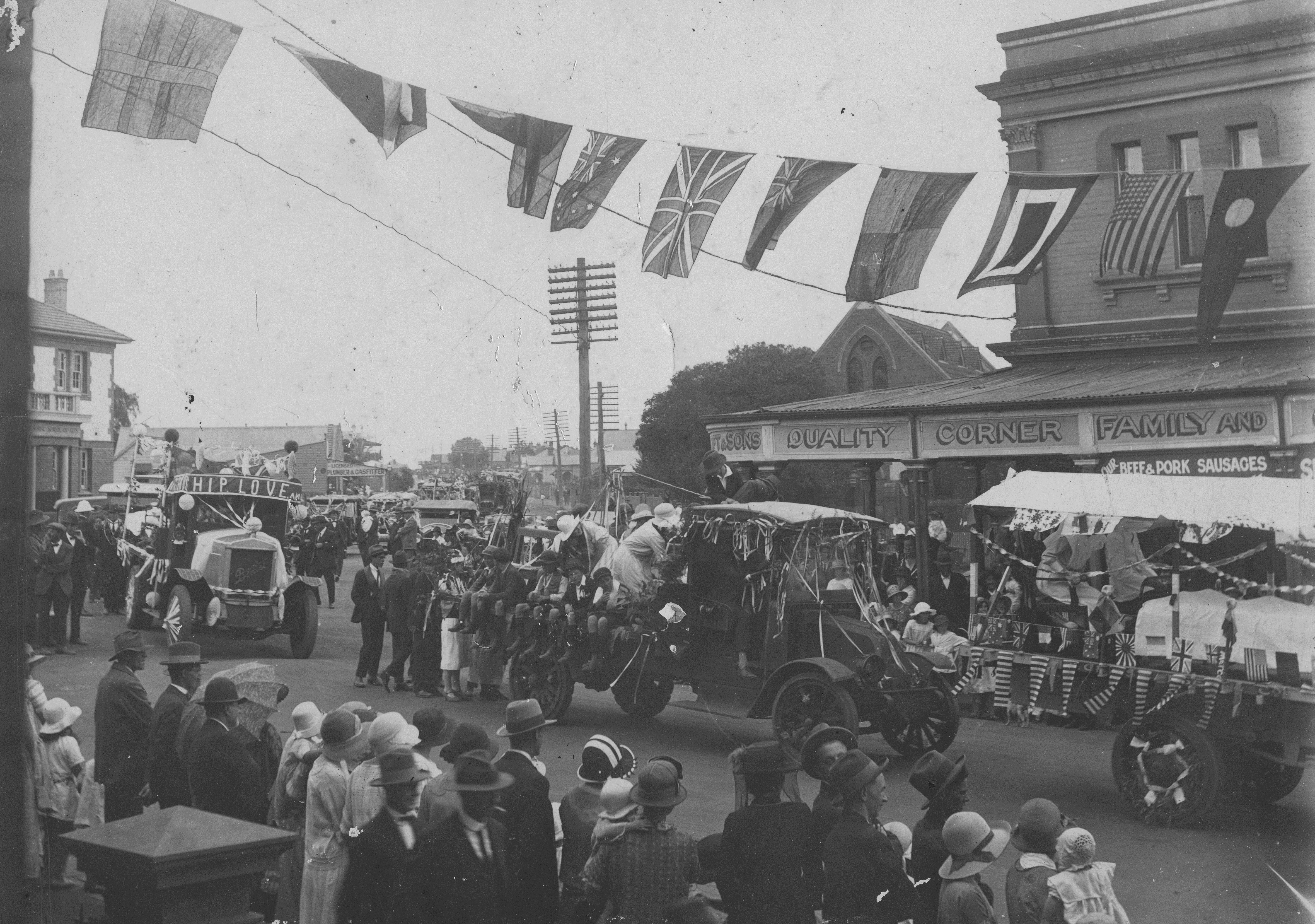
Parade in Liverpool on Scott Street, circa 1928
Until the 1950s, Liverpool was still largely agricultural, with many post-war residents taking up poultry farming and market gardening. However, the tidal surge of urban sprawl which engulfed the rich flatlands west of Sydney on the Cumberland Plain soon reached Liverpool.
Liverpool became an outer suburb of metropolitan Sydney with a strong working-class presence and manufacturing facilities. The Liverpool area also became renowned for its vast Housing Commission estates housing thousands of low-income families after the slum clearance and urban renewal programs in inner-city Sydney in the 1960s. Housing Commission Projects saw the population of Liverpool rise from 30,883 in 1961 to 82,447 in 1971.
Rapid development continued in the 1970s and 1980s, with the City’s population growing more than anywhere else in New South Wales in the 1990s.
Today Liverpool is a diverse and multicultural suburb. The 2011 census conducted by the Australian Bureau of Statistics showed that Liverpool’s population of 180,143 residents came from a wide variety of ethnic backgrounds; less than one-third (32.4%) of residents were born in Australia, which is less than half of the national average of 69.8%. The next most common countries of birth were Iraq (9.5%), India (5.9%), Croatia (4.0%), Fiji (3.2%) and Bosnia and Herzegovina (3.2%).
The 2021 Estimated Resident Population for Liverpool City is 234,917.
State Heritage Register Buildings in Liverpool

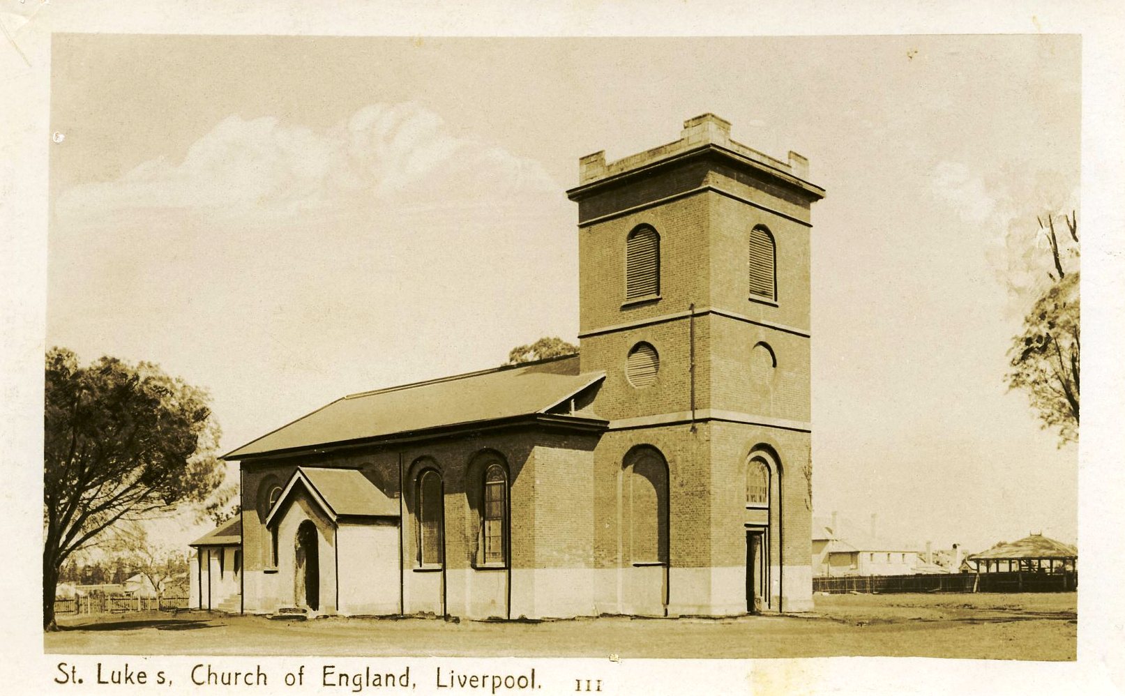
Postcard of St Luke's Church of England, Liverpool by Crown Studios Sydney, date unknown
The following buildings are listed on the Register of the National Estate or the State Heritage Register:
- Technical College (formerly Liverpool Hospital), probably designed by Francis Greenway, circa 1825–30
- Former Court House, corner of Bigge and Moore Streets, extended circa 1855
- Collingwood (also known as Captain Bunker's Cottage), Birkdale Crescent, circa 1810, extended circa 1860
- Liverpool Dam, Tucoreah-Georges River, built 1836, designed by David Lennox
- St Luke's Anglican church, designed by Francis Greenway, 1818
- Liverpool Railway Station
- Rosebank (formerly home of architect Varney Parkes), Speed Street, 1882–83
- Del Rosa (formerly home of Dr James Pirie), Speed Street
- Liverpool Fire Station, Terminus Street
- Memorial School of Arts, Macquarie Street, 1924
- New Commercial Hotel (formerly Ground Zero Hotel), corner Bigge and Scott Streets, 1896
Australian Bureau of Statistics. 1961 Census - Bulletin No 2 - Population and Dwellings in Local Government Areas (Canberra: Commonwealth Bureau Of Census And Statistics, 1961) Access: https://www.ausstats.abs.gov.au/ausstats/free.nsf/0/790FE8EEA9A8D6D8CA2578EA001E7F21/$File/1961%20Census%20-%20Bulletin%20No%202.pdf
Australian Bureau of Statistics. 1971 Bulletin 6. Population And Dwellings In Local Government Areas And Urban Centres (Canberra: Commonwealth Bureau Of Census And Statistics, 1971) Access: https://www.ausstats.abs.gov.au/ausstats/free.nsf/0/C62D3918BCA99584CA257884001849EA/$File/1971%20Census%20-%20Bulletin%20No%206%20-%20Population%20and%20Dwellings%20in%20LGA%20-%20Part%201%20NSW.pdf
See something missing?
You know your suburb better than anyone. If you think an important part of your suburb’s history is missing, whether recent or distant, reach out to the Local Studies Team through our online Local and Family History enquiry form. We are always looking for new ways to bring the vibrant history of Liverpool to life!
